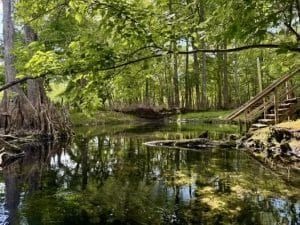
Spring shed
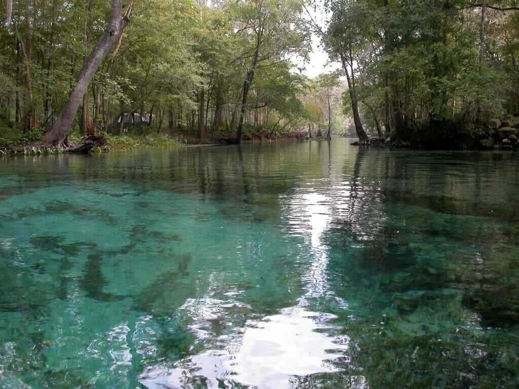
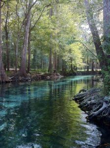
Springsheds are complex, cavern dominated, and partially interrelated systems that “should be treated as one until additional research can better delineate their boundaries (Upchurch et al. 2011).” The surrounding lands have high recharge capacity meaning everything above ground: fertilizer, herbicide, septic waste, and rain, trickles into our aquifer.
1. The Hornsby Springshed
- Group 1: Hornsby Springshed (Hornsby Springs Priority Focus Area)
- River Rise (Alachua) is a 1st magnitude spring in Alachua County in the Santa Fe Rise basin.
- Treehouse Spring (Alachua) is a 1st magnitude spring in Alachua County in the Treehouse Spring basin.
- Col428981 (Columbia) is a 3rd magnitude spring in Columbia County in the Santa Fe River basin.
- Darby Spring (Alachua) is a 2nd magnitude spring in Alachua County in the Santa Fe River basin.
- Hornsby Spring (Alachua) is a 2nd magnitude spring in Alachua County in the Hornsby Spring basin
- Columbia Spring (Columbia) is a 1st magnitude spring in Columbia County in the Columbia Springs basin.
2. The Poe Springs Springshed: Alligator, Poe, Lily, and Pickard
After Columbia Springs in the Hornsby Springshed, the Santa Fe River meanders back and forth forming the top half of a heart ending at the Columbia County Boat Ramp on CR 27. There the river straightens out to deliver a few springs beginning with a midriver boil also known as Alligator Spring. the following is a list of springs within the Poe Springshed.
- Alligator Spring (Alachua) is a 2nd magnitude mid-river spring in Alachua County in the Santa Fe River basin.
- Ala930971 (Alachua) is a 2nd magnitude spring in Alachua County in the Santa Fe River basin.
- Allen Spring (Columbia) is a 2nd magnitude spring in Columbia County in the Santa Fe River basin.
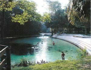
- Poe Spring (Alachua) is a 2nd magnitude spring in Alachua County in the Poe Spring basin.
- Poe Woods Spring (Alachua) is a 4th or higher magnitude spring in Alachua County in the Santa Fe River basin.
- Col930971 (Columbia) is a 2nd magnitude spring in Columbia County in the Santa Fe River basin.
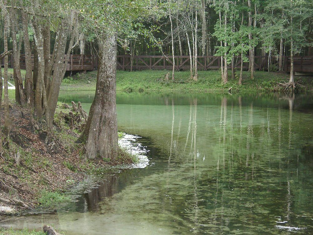
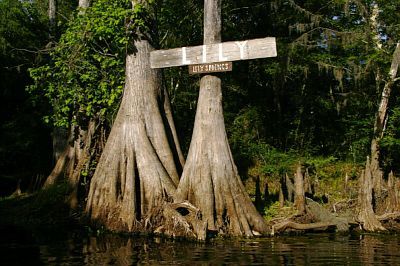
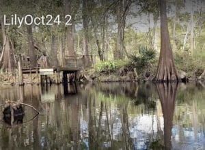
- Lily Spring (Gilchrist) is a 2nd magnitude spring on private property in Gilchrist County in the Santa Fe River basin.
- Pickard Spring (Gilchrist) is a 2nd magnitude spring on private property in Gilchrist County in the Santa Fe River basin.
- Col101971 (Columbia) is a 3rd magnitude spring in Columbia County in the Santa Fe River basin.
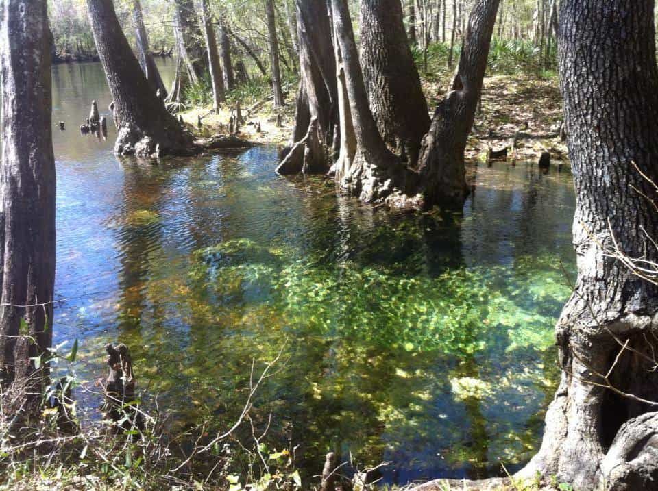
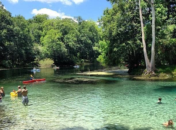
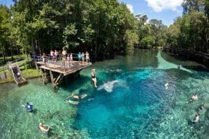
3. Gilchrist Blue Springshed
Jonathan, Rum Island, Gilchrist Blue, and Naked Springs are within the Gilchrist Blue Springshed, a sub-basin of the Devils Eye Springshed. The following is a list of springs within the Gilchrist Blue Springshed:
- Jonathan Spring (Columbia) is a 3rd magnitude spring in Columbia County in the Santa Fe River basin.
- Col101974
- Col101975
- Rum Island Spring (Columbia) is a 2nd magnitude spring in Columbia County in the Blue Spring (Gilchrist County) basin.
- Gilchrist Blue Spring (Gilchrist) is a 2nd magnitude spring in Gilchrist County in the Blue Spring (Gilchrist County) basin.
- Naked Spring (Gilchrist) is a 4th or higher magnitude spring in Gilchrist County in the Blue Spring (Gilchrist County) basin.
- Little Blue Spring (Gilchrist) is a 4th or higher magnitude spring in Gilchrist County in the Blue Spring (Gilchrist County) basin.
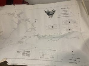
4. Devils Ear Springshed (Devils Ear, Eye, July, Ginnie, Dogwood, Deer, Sawdust)
The Devils Ear Springshed consists of more than 200,000 acres of land that contribute water to the following group of springs:
Devils Ear is the only designated Outstanding Florida Spring (OFS) within this Springshed. This springshed is IMPAIRED due to high nitrates levels which are 73% higher than the state designated safe level. As a result, a Basin Management Action Plan (BMAP) has been enacted to reduce nitrate loading within this basin.
The Ginnie Springs Complex include Devils Eye, Ear, Little Devil, Ginnie, Dogwood, Twin, and Deer springs. These springs are all within privately run Ginnie Springs Outdoors, LLC . The Suwannee River Water Management District (SRWMD) has permitted up to 1 million gallons per day (mgd) to be withdrawn from wells within the Ginnie Springs complex. The water is pumped from wells near Ginnie by Seven Springs Water Co. which then sells he water to Blue Triton, formerly known as Nestle Waters North America.
Ginnie Springs Complex which include Devils Ear, Devils Eye, Little Devil, Ginnie, Dogwood, Twin, and Deer Springs.
Sawdust Spring (Columbia) a 3rd magnitude spring in Columbia County.
5. Sunbeam-Wilson Springshed
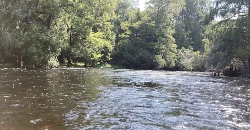
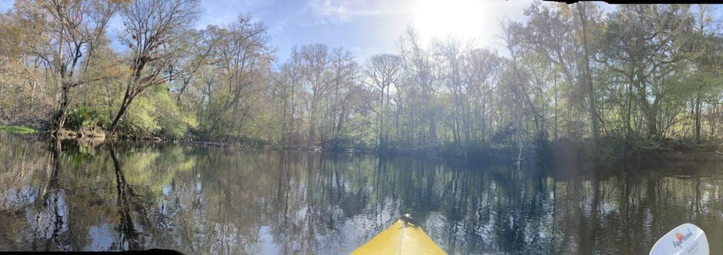
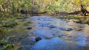
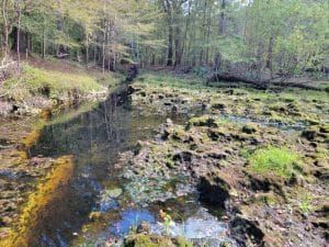
Between the Devils Ear and Ichetucknee Springsheds lie a couple of spring clusters spaced fairly well apart. The first cluster is dominated by the Siphon Creek Cave System. Siphon Creek Rise qualifies as a First Magnitude resurgent spring. Big Awesome, Little Awesome, and Myrtles Fissure are also part of this cave system.
Big Awesome swallets “is the most upstream of the Siphon Creek Cave System.” Accessible by boat, on the right side of the river heading downstream, after the shoals, marked by a large cypress, jog into a canopied space beside an island, and is dominated by a big circular pool. The hole is surrounded by a ledge. SRWMD once estimated that Big Awesome swallet takes in about 150 cfs.
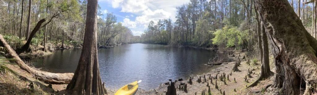
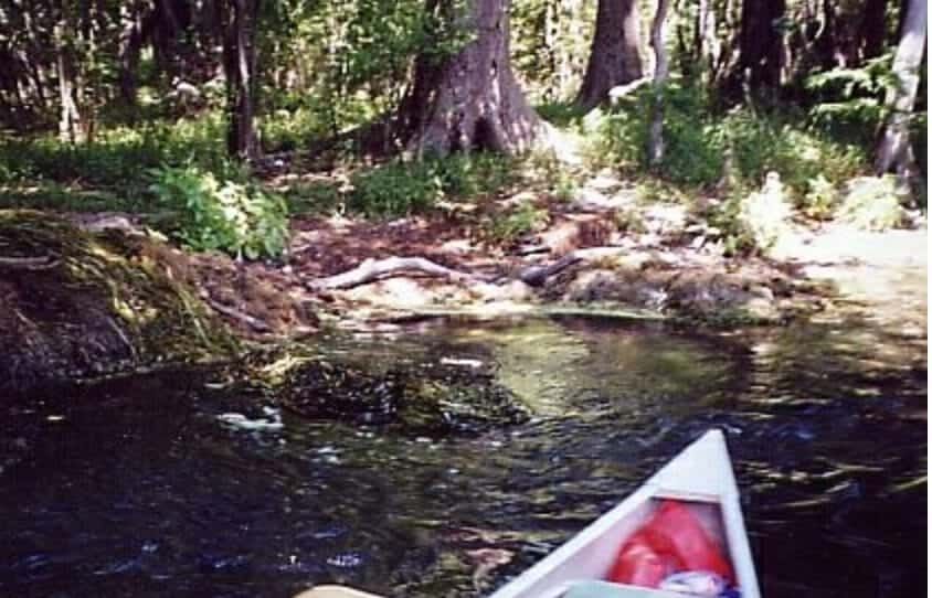
In 2021, Alachua Conservation Trust purchased a 195 acre tract of land on the Santa Fe River and called it Little Awesome Preserve. The name Little Awesome refers to a feature on the Santa Fe River that is only accesible by boat and not always visible. Recently it has been covered by a large tree trunk and hidden from view. Other times it is covered in vegetation. When the river is high enough to submerge this circular ‘portal,’ it emits the rushing sound of water swirling down a drain. When I first encountered Little Awesome, I feared it. The force of the water rushing down this circular chimney appeared like it could pull my canoe down. After a time I realized it was safe to canoe over it, even allowing myself to submerge into it and allowing the siphon to spin me around.
The list of springs in this cluster and more going downstream include:
- Col1012971 (Columbia) is a 2nd magnitude spring in Columbia County in the Santa Fe River basin.
- Col1012972 (Columbia) is a 2nd magnitude spring in Columbia County in the Siphon Creek Rise (Gilchrist County) basin.
- Gil1012971 (Gilchrist) is a 2nd magnitude spring in Gilchrist County in the Siphon Creek Rise (Gilchrist County) basin.
- Gil1012972 (Gilchrist) is a 3rd magnitude spring in Gilchrist County in the Siphon Creek Rise (Gilchrist County) basin
- Siphon Creek Rise (Gilchrist) is a 1st magnitude spring in Gilchrist County in the Siphon Creek Rise (Gilchrist County) basin.
- Myrtles Fissure Spring (Gilchrist) is a 2nd magnitude spring in Gilchrist County in the Santa Fe River basin.
- Gil1012974 (Gilchrist) is a 2nd magnitude spring in Gilchrist County at the 47 bridge.
- Gil928972 (Gilchrist) is a 4th or higher magnitude spring inland from the river about 50 yards in an area of deep floodplain forest.
- Col928971 (Columbia) is a 3rd magnitude spring in Columbia County in the Santa Fe River basin.
- Wilson Spring (Columbia) is a 2nd magnitude spring in Columbia County in the Santa Fe River basin.
- Unnamed Spring (Gilchrist) is a 4th or higher magnitude spring in Gilchrist County in the Santa Fe River basin.
- Gil99974 (Gilchrist) is a 3rd magnitude spring in Gilchrist County in the Santa Fe River basin.
- Col917971 (Columbia) is a 3rd magnitude spring in Columbia County in the Santa Fe River basin.
- Jamison Springs (Columbia) is a 3rd magnitude spring in Columbia County in the Santa Fe River basin.
- Sunbeam Spring (Columbia) is a 2nd magnitude spring in Columbia County in the Santa Fe River basin.
- Oasis Spring (Gilchrist) is a 3rd magnitude spring in Gilchrist County in the Santa Fe River basin.
Little Awesome Suck, also on the right is higher on the bank and the only one that will become isolated from river inflow during periods of very low water levels and is often obscured by fallen vegetation. Surrounded by sharp karst rocks it forms a nearly circular hole that sometimes forms a whirlpool. “The SRWMD once estimated that Little Awesome Suck was taking in about 50 cfs.”
Myrtles Fissure churns out water with the energy of a waterfall or becomes a deep, narrow, stagnant slit of water on the upper banks of the Santa Fe. The fissure is not visible from the river and can the sharp slippery run can be accessed by boat, or through a hike along the riverside through the ACT’s Little Awesome Preserve. The fissure runs parallel to the river, is about 120′ from the river, is around 75′ long, 4′ wide. The shallow run of sharp karst is slippery. During high water, water gushes like a waterfall from the fissure and down the run to the river. One hears it before seeing it. When the river is low, water stagnates in the crack and the run is coated with algae.
6. Ichetucknee Springshed
Of the nine named springs along the upper 2.5 mile section of the Ichetucknee River, six are Outstanding Florida Springs (OFS): Ichetucknee Head (OFS), Cedar Head , Blue Hole (OFS) , Mission Spring Group (OFS) , Roaring and Singing , Devils Eye (OFS), Grassy Hole (OFS), Mill Pond (OFS) and Coffee.
Outstanding Florida Springs are historic first magnitude springs that are legally protected by Senate Bill 552 “Florida Springs and Aquifer Protection Act,” requiring that minimum levels (MFLs) be set. The MFL’s are NOT being met and the Suwannee River Water Management District (SRWMD), is claiming that an unfunded wetland project with a 20 year completion date will restore our spring flow rather than restricting water use permits.
The Ichetucknee ‘Trace’ refers to the path lakes, creeks, and surface waters take to the Ichetucknee Headspring. In a sense, all springsheds have these traces. The Ichetucknee Trace is well documented thanks to the dedication of geologists, divers, and other dedicated individuals. Jim Stevenson, retired chief biologist with the Florida Park Service presents this first recorded field trip with the help of a grant from the Columbia County Board of County commissioners. Produced by Lake City Community College, Stevenson takes a group of Columbia High School Students on a tour of the trace. This video manages to connect the trace of the water’s path to the Headspring of the Ichetucknee from Lake City.
In 2019, Gary Maddox, Rick Copeland, and Kate Muldoon published Development of Karst Traces in the Santa Fe Basin. This paper and field trip was a collaboration of many of our regions’ scientists and explorers. The publication is a wealth of geological, hydrological, and botanical exploration. Development of Karst Traces in the Santa Fe Basin, 2019, February 23, 2019, Southeastern Geological Society,
7. Three Rivers to the Suwannee
Between the Devils Ear and Ichetucknee Springsheds lie a couple of spring clusters spaced fairly well apart. The first cluster is dominated by the Siphon Creek Cave System. Siphon Creek Rise qualifies as a First Magnitude resurgent spring. Big Awesome, Little Awesome, and Myrtles Fissure are also part of this cave system.
Big Awesome swallets “is the most upstream of the Siphon Creek Cave System.” Accessible by boat, on the right side of the river heading downstream, after the shoals, marked by a large cypress, jog into a canopied space beside an island, and is dominated by a big circular pool. The hole is surrounded by a ledge. SRWMD once estimated that Big Awesome swallet takes in about 150 cfs.
In 2021, Alachua Conservation Trust purchased a 195 acre tract of land on the Santa Fe River and called it Little Awesome Preserve. The name Little Awesome refers to a feature on the Santa Fe River that is only accesible by boat and not always visible. Recently it has been covered by a large tree trunk and hidden from view. Other times it is covered in vegetation. When the river is high enough to submerge this circular ‘portal,’ it emits the rushing sound of water swirling down a drain. When I first encountered Little Awesome, I feared it. The force of the water rushing down this circular chimney appeared like it could pull my canoe down. After a time I realized it was safe to canoe over it, even allowing myself to submerge into it and allowing the siphon to spin me around.
Florida Springs Institute ‘s Interactive Florida Springs Map allows the user to select a spring from the map to see an image of the spring with detailed information. The Interactive Map is a composite of decades of research by the Florida Geological Survey originally published in 1947and updated in 1977. “In recent decades, much has been learned about additional spring resources unreported in earlier compilations. In addition, a great deal of water chemistry information has been gathered to enable long-term trend analysis and interpretative dynamics of our subsurface aquifer flow regimes.” Springs of Florida.
The springs in the Three Rivers section include the following:
- At the confluence of the Ichetucknee and the Santa Fe, there is Suw917971 (Suwannee) is a 3rd magnitude spring in Suwannee County in the Ichetucknee River basin.
- Gil99972 (Gilchrist) is a 3rd magnitude spring in Gilchrist County in the Santa Fe River basin.
- Troop Spring (Gilchrist) is a 3rd magnitude spring in Gilchrist County in the Santa Fe River basin.
- Suw917972 (Suwannee) is a 4th or higher magnitude spring in Gilchrist County in the Santa Fe River basin.
- Campground Spring (Gilchrist) is a 3rd magnitude spring in Gilchrist County in the Trail Springs basin.
- Gil107972 (Gilchrist) is a 2nd magnitude spring in Gilchrist County in the Trail Springs basin.
- Trail Spring (Gilchrist) is a 3rd magnitude spring in Gilchrist County in the Trail Springs basin.
- Suw107971 (Suwannee) is a 2nd magnitude spring in Suwannee County in the Santa Fe River basin.
- Gil107971 (Gilchrist) is a 2nd magnitude spring in Gilchrist County in the Santa Fe River basin.
- Gil729971 (Gilchrist) is a 2nd magnitude spring in Gilchrist County in the Santa Fe River basin.
Threats to the Santa Fe River
Three of the greatest threats to our springs and river are
Nutrient pollution (fertilizer)
Consumptive Use
Loss of Recharge Areas
Nutrient pollution (fertilizer)
Fertilizer: Phosphates/Nitrates
Plant nutrients nitrates and phosphates feed the algal blooms which kill off native aquatic plants; the food source to local wildlife.What we are doing and how you can help:
- Promoting Aquifer Friendly gardening through our outreach programs
- BMAPS- Basin Management Action Plan is FL-DEP’s response
Mining Threats: Mining processes destroy wetlands and produce toxic waste-streams.
- The mining process destroys vegetative cover and damages intricate water retention and drainage systems, emptying lakes and creating unprecedented flood zones. Creates toxic wastewater.
- Phosphate mine in Hamilton County, Nutrien.
- Creates toxic gypstacks that release toxic chemicals into the air and into our aquifer.
- Titanium and rare earth mine in Bradford County; Chemours.
- Wastewater containing radium and barium are released into the headwaters of our Santa Fe River.
What we are doing and how you can help:
Working with regulatory agencies to press for greater regulation.
Aquatic Invasives- FWC and Diquat
Monitoring mining wastewater spills and notifying environmental and regulatory groups.
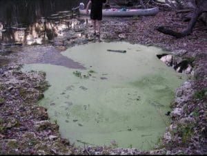
- Water Hyacinth (Eichhornia crassipes) is one of the fastest growing invasives in our rivers. it forms dense, impenetrable mats which clog waterways, making boating, fishing and almost all other water activities impossible. It also reduces biodiversity by crowding our native plants at the water’s surface and below.
- Water hyacinth is controlled by FWC contractors using Diquat, a broad spectrum herbicide.
- Diquat is toxic to fish and mammals
What we are doing and how you can help:
- Join us on our harvesting events. We pull the invasives so the FWC does not spray herbicides
- We focus on efforts near shoals where plants grow into mats.
- If you own property on the river, talk to us about how you can help
- Tell people about our efforts to stop the spraying of herbicides on our river.
- Become a member of Our Santa Fe River and support our efforts.
Consumptive Use: Groundwater withdrawal and MFL’s Minimum Flow Levels
Water bottling
- Seven Springs Water Company pumps nearly 1 million gallons of water per day from the wells at Ginnie Springs Outdoors, LLC., to sell to Nestle/BlueTriton for bottling.
- Water use permitting is supposed to protect our springs and rivers from over-pumping, but it is failing. The permit was approved even though it is clearly not in the public interest to increase pumping from a spring/river system already considered by the state as “in recovery,” a designation given to rivers “experiencing significant harm” to water levels and flow.
What we are doing and how you can help:
- Do not purchase bottled water in single use plastic and encourage your circle of family and friends as well.
- Support Florida Springs Council in their legal challenges to the permit.
- Join OSFR and support our efforts to turn the tide in favor of better protections.
- Sign the single use plastic pledge.
Landscape Irrigation
- 40-60% of household water use goes to irrigating landscapes dominated by turf grass and exotic or non-native plants.
- Soils in our area are typically sandy and have no water retention.
What we are doing and how you can help:
- Encourage landscaping with native plants adapted to our heat and are drought tolerant.
- Eliminate lawns.
- Adopt soil building practices such as mulching.
Loss of Recharge areas
Protecting surface waters, wetlands and groundwater requires us to avoid developing in high recharge areas.
- Preserve open space
- Retain tree canopy and native landscapes
- Minimize building footprint
- Minimize total impervious area
What we are doing and how you can help:
- Speak out against high density developments in vulnerable recharge areas such as along the Ichetucknee Trace and around Mill Creek Sink.
- Support the efforts of land protection agencies like Alachua Conservation Trust, Florida Forever,